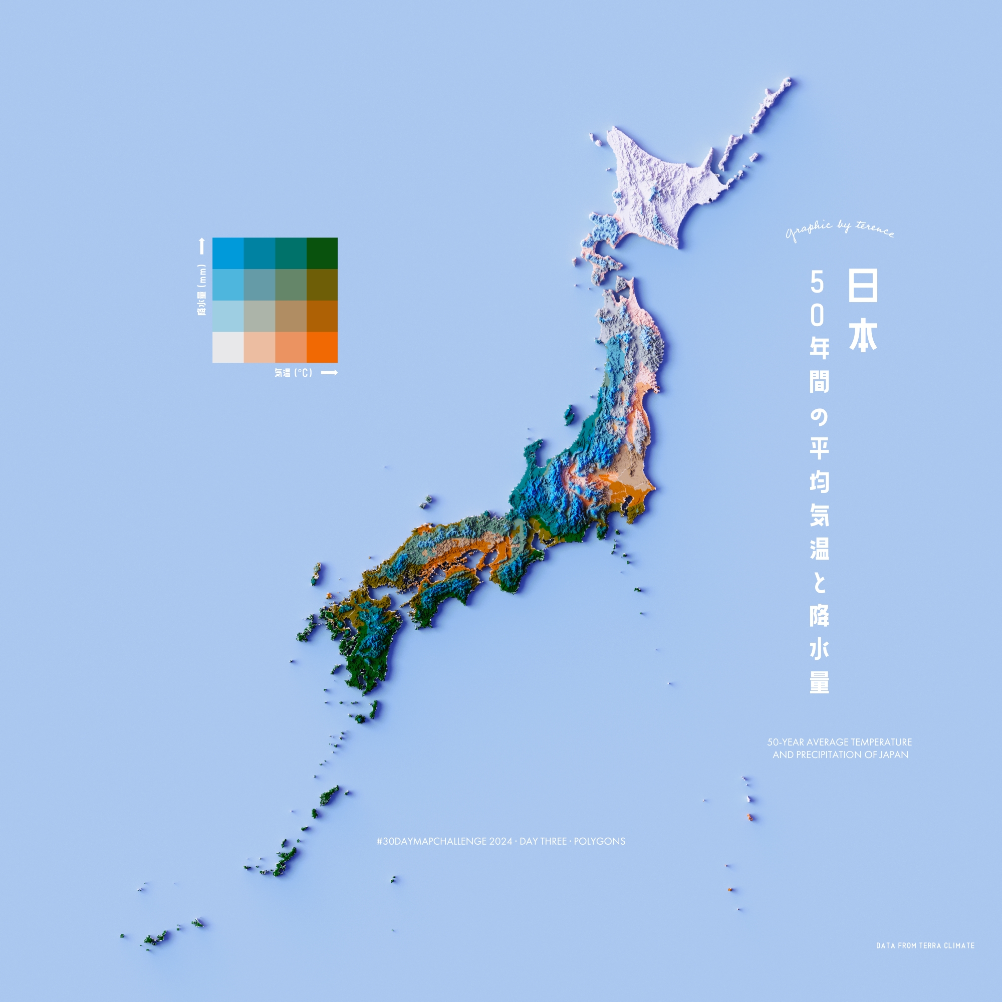
Japan Climate Map
Climate classification and temperature distribution across the Japanese archipelago.
A collection of cartographic visualizations
Climate classification and temperature distribution across the Japanese archipelago.
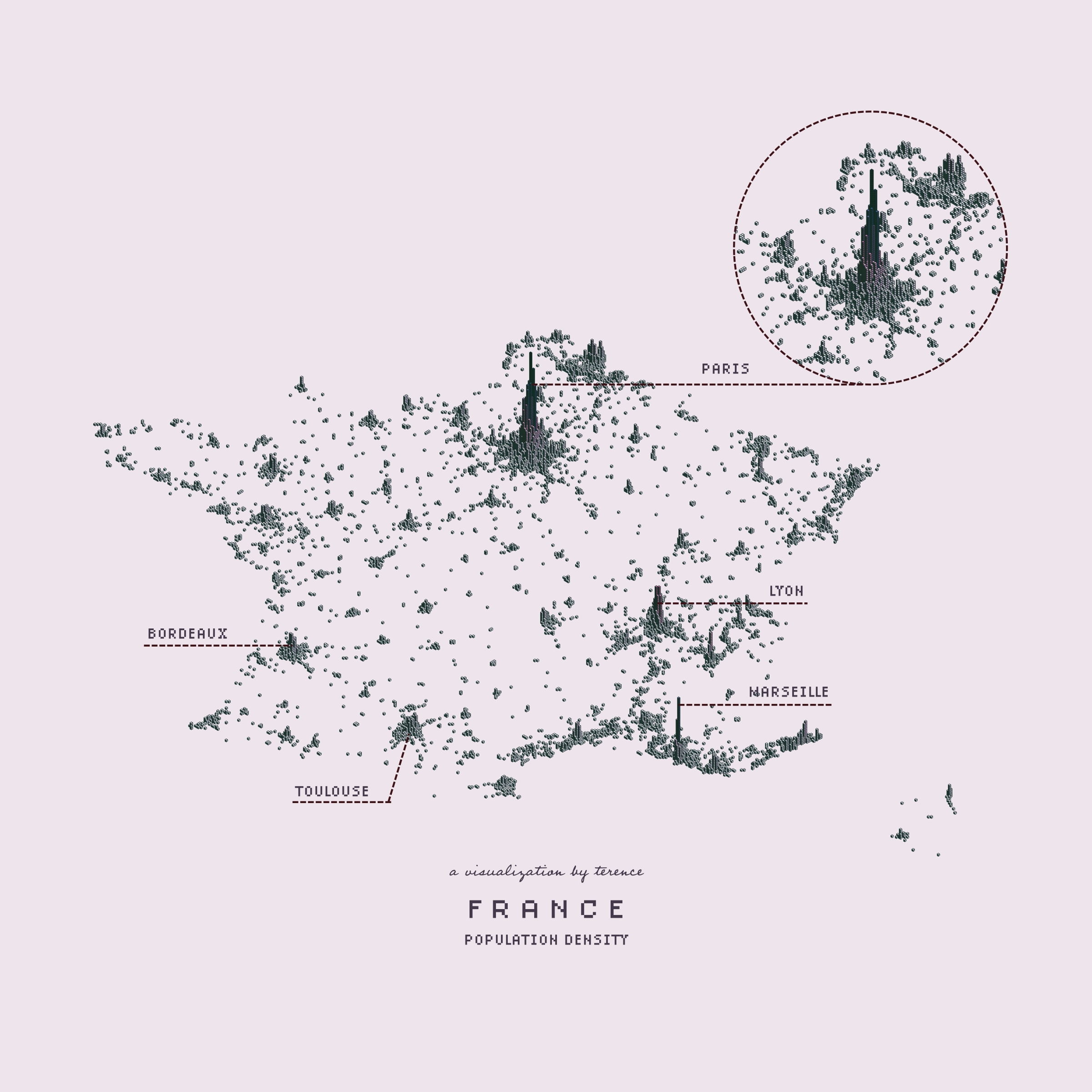
Population density visualization showing urban concentration patterns in France.
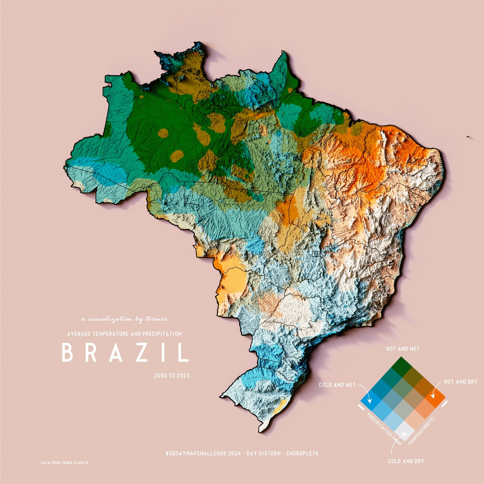
Statistical choropleth map displaying regional data distribution across Brazilian states.
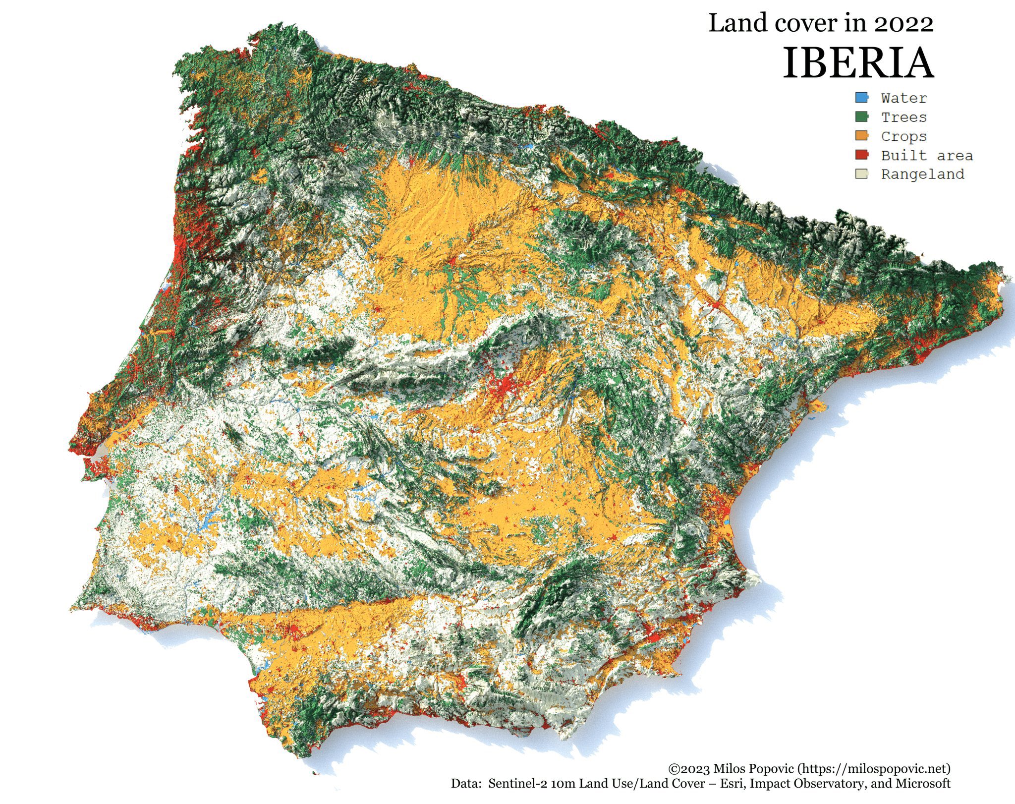
Land use and vegetation coverage mapping of the Iberian Peninsula.
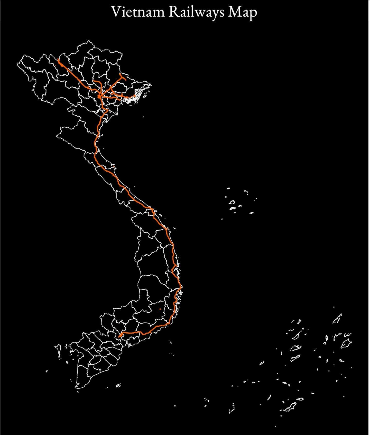
Comprehensive visualization of Vietnam's railway infrastructure and connections.
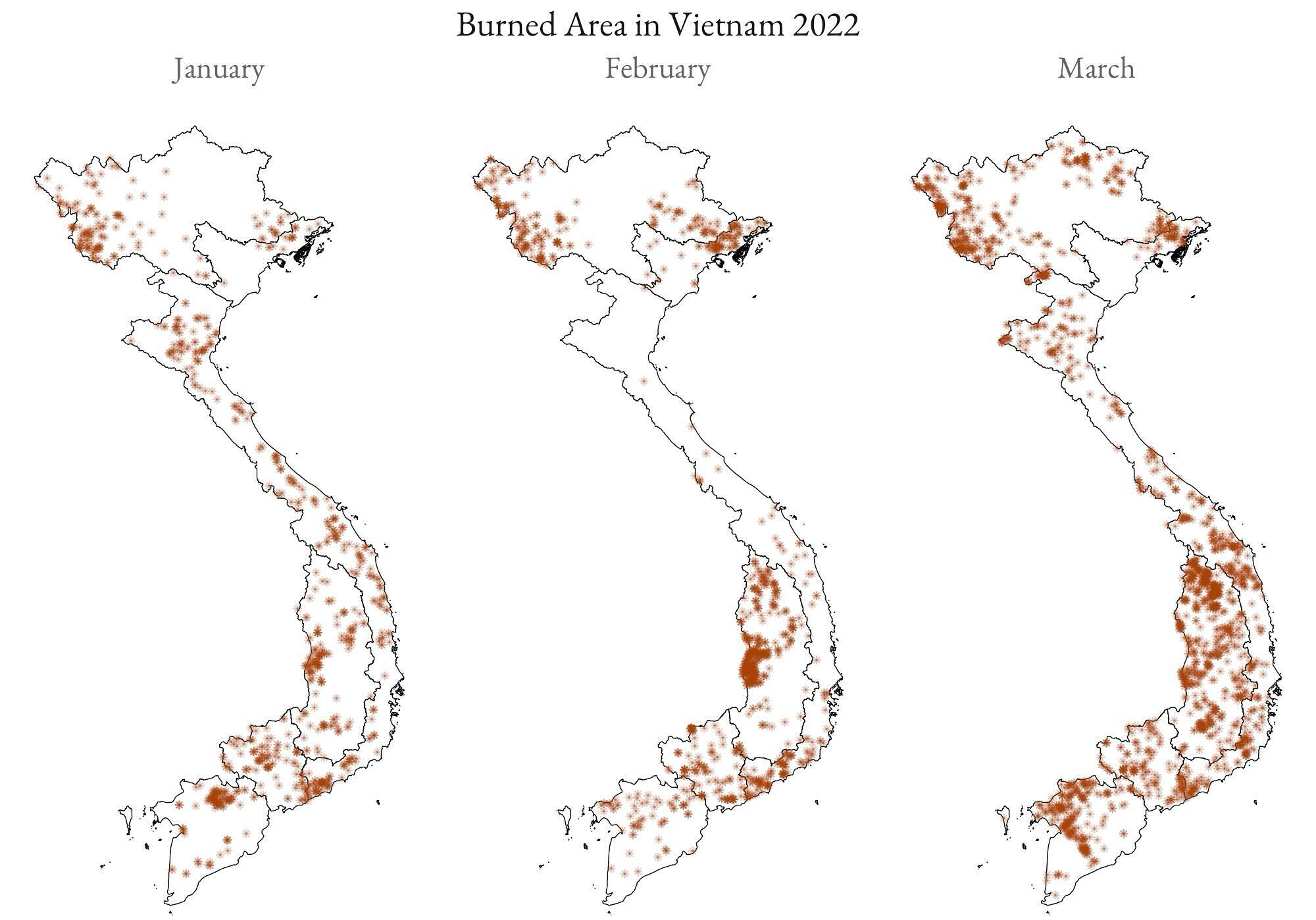
Geospatial analysis of fire incident distribution and hotspots across Vietnam.
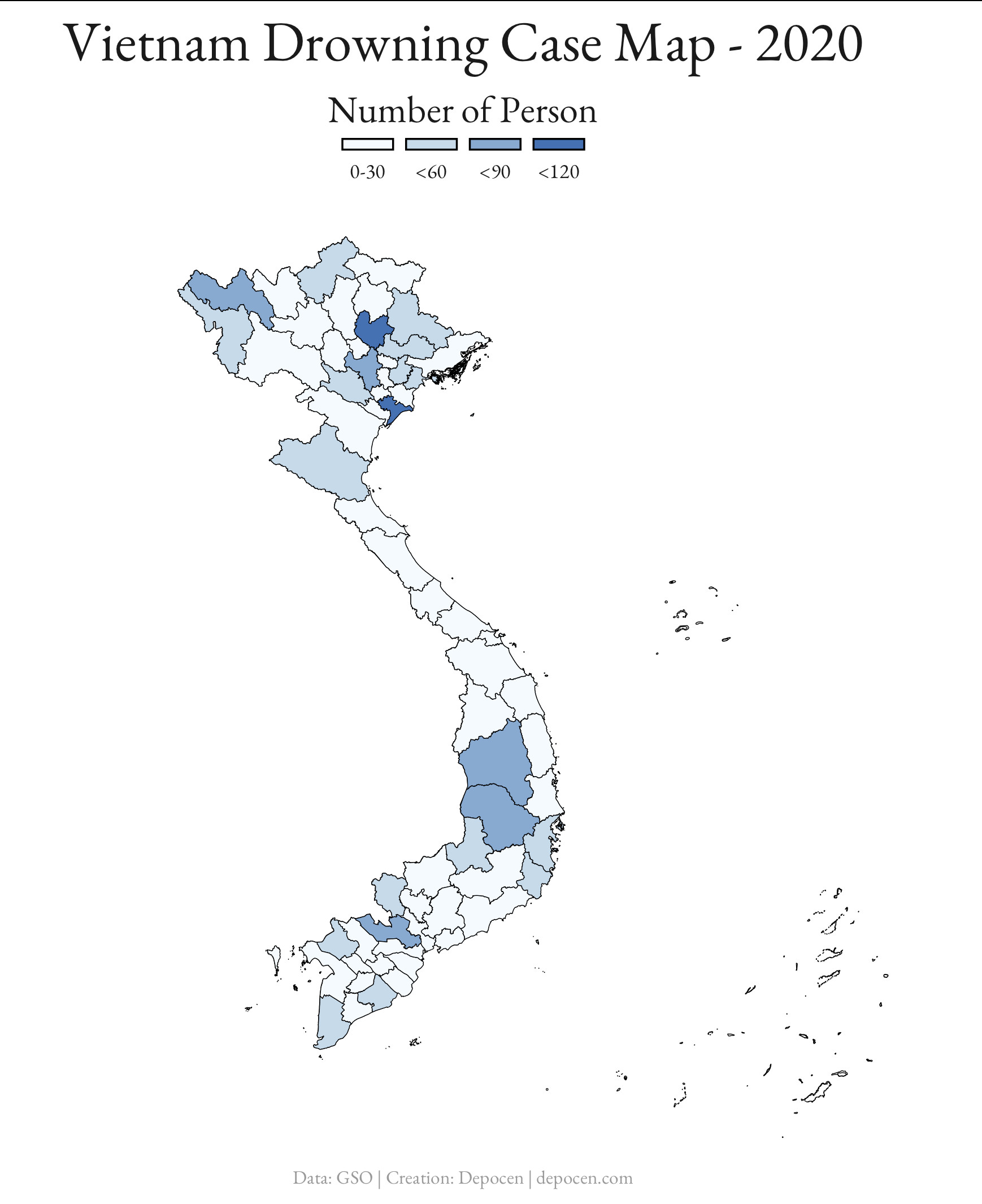
Spatial mapping of drowning incidents for risk assessment and prevention planning.
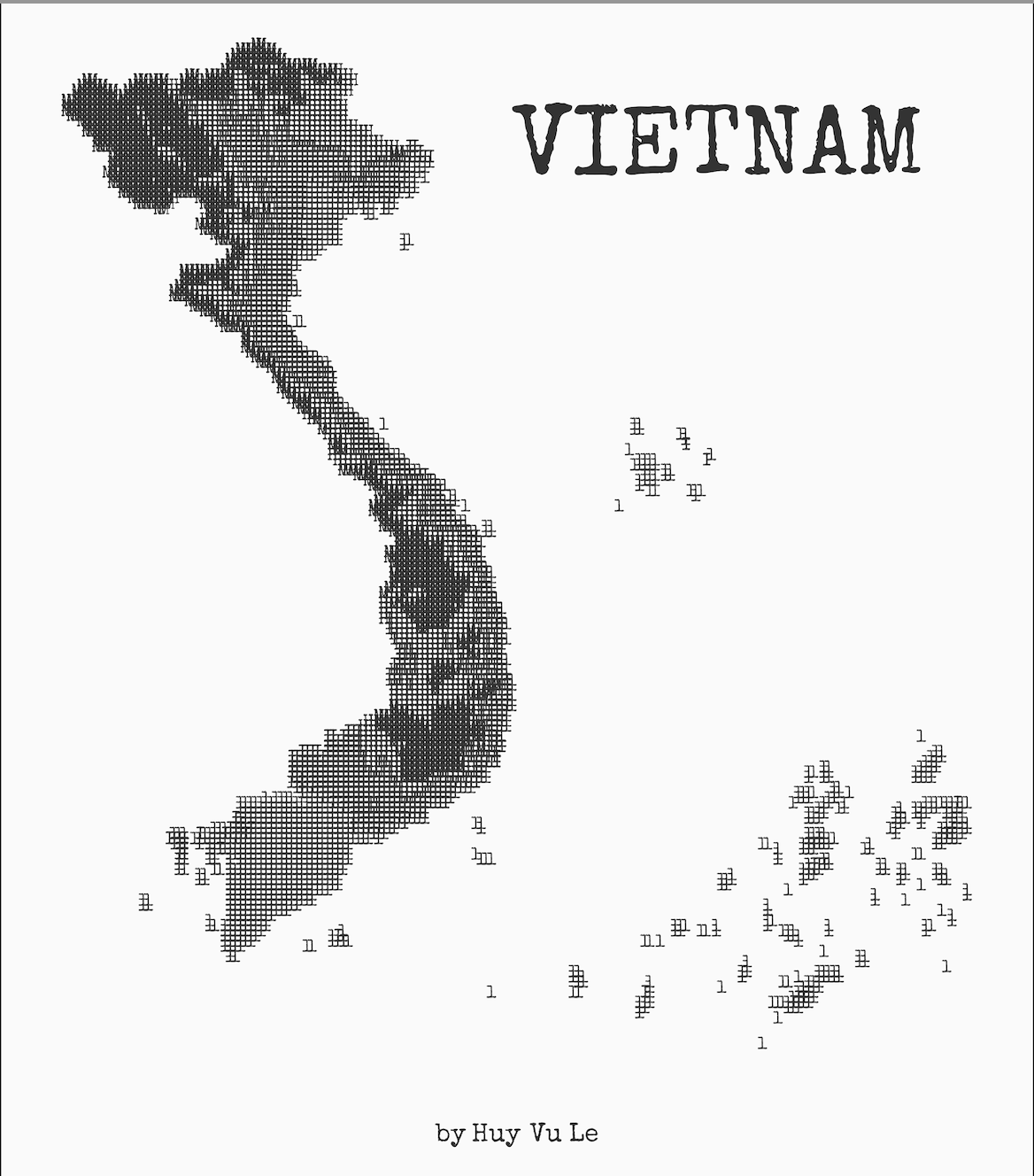
Open data visualization showcasing publicly available geographic information.
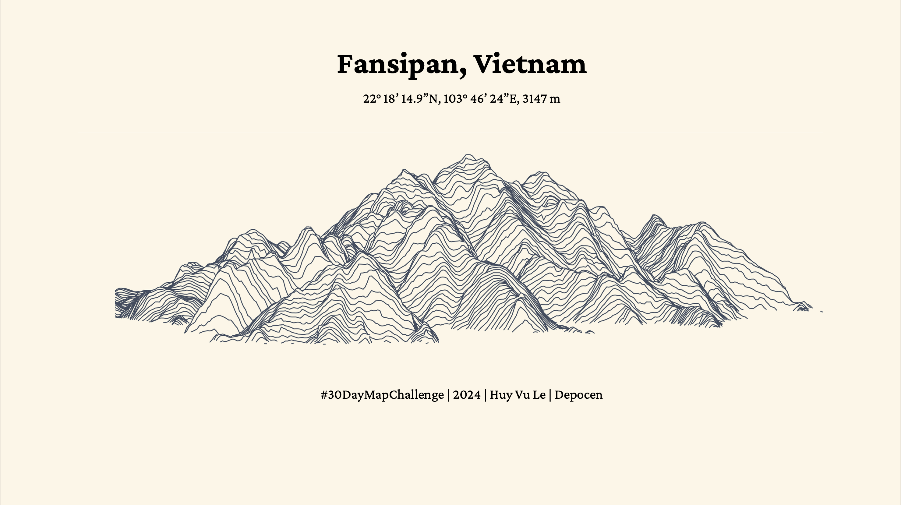
Elevation contour lines revealing the topographic relief of Vietnam.
Detailed topographic representation showing terrain features and elevations.